USV

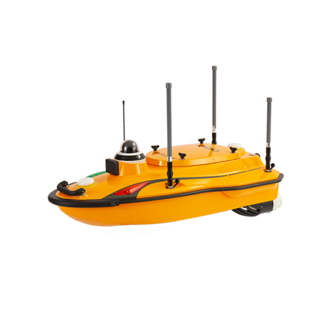
APACHE3 PRO USV
Compact, high-performance marine
drone with single beam echosounder
and GNSS/INS technology for a wide
range of hydrographic survey
applications.
MILLIMETER-WAVE AUTOMATIC OBSTACLE AVOIDANCE
The APACHE 3 Pro comes standard with a millimeter-wave obstacle avoidance system to detect obstructions in a wide 110° angle ahead. When it encounters an obstacle, the USV autonomously charts a detour course around it, effectively minimizing the potential risk of collision damage during operation.
REAL-TIME DATA FOR GREATER SECURITY AND PRODUCTIVITY
A combination of SIM, and network bridge with automatic switching capabilities ensures reliable communications. In addition, cloud-based remote monitoring is seamlessly integrated to provide real-time information on the status of the Apache 3 Pro, enhancing its control and security. The use of 4G and 2.4G networks eliminates distance limitations and enables efficient data exchange in a variety of operating environments.
ENABLING SURVEYS IN DIVERSE WATER CONDITIONS
The semi-recessed motor and innovative internal rotor motor design provide the APACHE 3 Pro with a shallower draft, enhancing the USV's ability to navigate different water depths. The motor design provides extra protection, reducing the risk of damage and ultimately extending the motor's service life.
MAINTAIN HIGH ACCURACY UNDER BRIDGE
APACHE 3 Pro ensures consistent accuracy even when navigating under bridges. If the GNSS signal is lost, the USV maintains its course by automatically navigating under bridges and continuously providing high-precision position data. Accurate position and attitude data also compensate for the effects of hull sway on survey results. Tight integration of GNSS and INS sensors eliminates data outliers and ensures the reliability of the information collected.
LIGHTWEIGHT DESIGN
The APACHE 3 Pro is constructed from macromolecular polyester carbon fiber and Kevlar glass fiber, resulting in a remarkably light weight of only 10 kg (excluding sensors). This design allows a single operator to effortlessly manage a variety of remote deployment scenarios, ensuring versatility and ease of use in a wide range of operating conditions.
SINGLE-BEAM ECHOSOUNDER FOR BATHYMETRIC SURVEY
APACHE 3 Pro comes standard with a D270 single-beam echo sounder. It is portable and integrates a built-in water temperature sensor to enable real-time sound velocity correction in response to temperature changes, resulting in superior depth measurement accuracy.
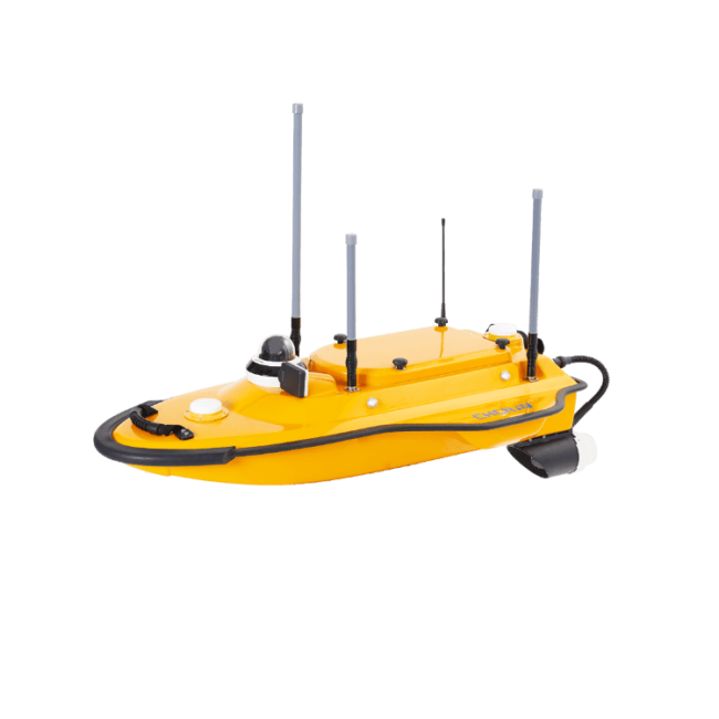
APACHE3 USV
Cost-effective single beam marine drone.
ONE-MAN OPERATION
Made of macromolecule polyester carbon fiber and Kevlar fiber-glass weighting 7 kg without sensors. It can be carried by a single person during the entire project from on-site transport, installation, calibration, and mission processing.
MAINTAIN HIGH ACCURACY
The integration of GNSS and IMU sensor provides accurate position and attitude data to compensate for hull sway on survey results. The Apache3 provides consistently high accuracy positions even during temporary GNSS outages while passing under bridges. Tight integration of GNSS and INS data eliminates outliers.
MAKE SURVEY POSSIBLE IN MOST WATER CONDITIONS
High-efficiency maritime design propulsion DC-injection rotary motor technology provides a 40% increase in energy conversion efficiency. The motor's high speed (7,000 rpm), anti-collision design with a sealed straw cover with oblique titanium alloy mesh and anti-corrosion design (resistant to one month's immersion in sea water) make it extremely durable.
ABSOLUTE LINEAR TECHNOLOGY
Integrate high precision GNSSpositioning and heading technology to ensure high accuracy bathymetric survey in fully autonomous mode. With less than 1 m length and pocket-hulled vessel design, the APACHE3 supports operation in shoals, channels, and shallow rivers for the bathymetric survey without run aground.
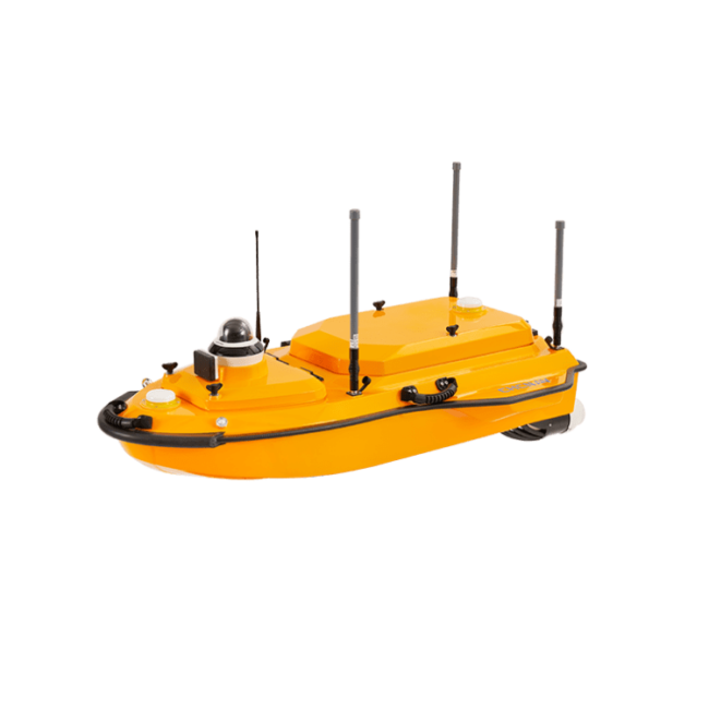
APACHE4 USV
Autonomous hydrographic and
bathymetric surveys USV
ADVANCED NAVIGATION CONTROLLER
The autonomous control system enables APACHE 4 to navigate straight along the cross-section according to the profile view when the flow rate, turbulence, etc., changes. The hovering technology can make APACHE 4 hover stably in the turbulent flow at the start and end points of ADCP observation, thereby improving the accuracy of flow estimation.
SMARTER CONNECTIVITY THAN EVER
The i83 GNSS offers built-in Wi-Fi, Bluetooth, NFC, 4G, and UHF modems for seamless GNSS surveying. It supports RTK Networks, UHF base-rover setups, and precise positioning in all scenarios. With a high-resolution display, it functions as a UHF RTK base station, network rover, or records data for post-processing, ensuring complete survey control.
COMPATIBLE WITH COMMON ADCPs
The APACHE 4 central access shaft design provides unmanned cross-sectional flow measurement solutions for the leading ADCPs on the market. The APACHE 4 is particularly suited for hydrologists using ADCP sensors such as the M9, RTDP 1200, RiverPro, and RiverRay, who are looking for an integrated, portable, and affordable unmanned solution. It does not only carry the ADCP but also provides its positioning, orientation, power, waterproofing, network, and 4G transmission solutions.
BUILT-IN SINGLE BEAM ECHO SOUNDER
Single beam sounding data can be used to verify the accuracy of ADCP bottom tracking data and even fed directly into the ADCP flow measurement software to compensate for the unavailability of ADCP data, and at the same time, provides water depth profile data associated with the flow velocity profile measurement.
SMART POSITIONING AND NAVIGATION
APACHE 4 provides a stable position and heading to the ADCP and autopilot. Its IMU sensor ensures the availability of position data even during momentary GNSS signal loss. The obstacle avoidance radar system and live video feed ensure safe operations in case of loss of visibility or difficult environmental conditions. Completely autonomous, the APACHE 4 is safely operated from the shore. The AutoPlanner and HydroSurvey software suite allows the operator to define the entire mission, from the survey area to the export of the results.
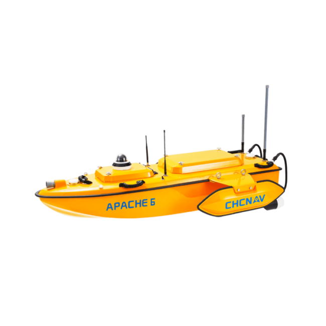
APACHE6 USV
Turnkey multibeam echosounder
autonomous USV system.
LIGHTWEIGHT FOR EASY DEPLOYMENT
Made of macromolecule polyester carbon fiber and Kevlar fiber-glass weighting 15 kg without sensors.
HIGH PERFORMANCE TRIPLE-HULLED VESSEL DESIGN
Its dual detachable floating bodies keep the hull balanced even in the rapid current situation. Removing the floating bodies allows operation in shoals, channels and shallow rivers without run aground.
OPTIMIZED FOR NORBIT MULTIBEAM ECHOSOUNDERS
APACHE 6 design is optimized for the NORBIT iWBMSe, iWBMS and iWBMSh-STX series offering with high end performances to match the most demanding hydrographic survey requirements.
OPTIONAL TERRESTRIAL MAPPING LASER SENSOR
The optional NORBIT iLiDAR mapping sensor provides high-accuracy combined marine and terrestrial 3D survey in a single pass saving significant processing time when performing harbor and river surveys with height clearance evaluation.
e-Newsletter
Sign up for our newsletter to stay updated on the latest innovations, product launches, insightful case studies, and exclusive event invitations.
CONTACT US
- [email protected]
- +61 730 400 587
- Australia
Explore
- Our Services
- Products
- About Us
company
- Support
- Distributions
- Case Study
help center
- Contact
- Feedback