Mobile Mappers

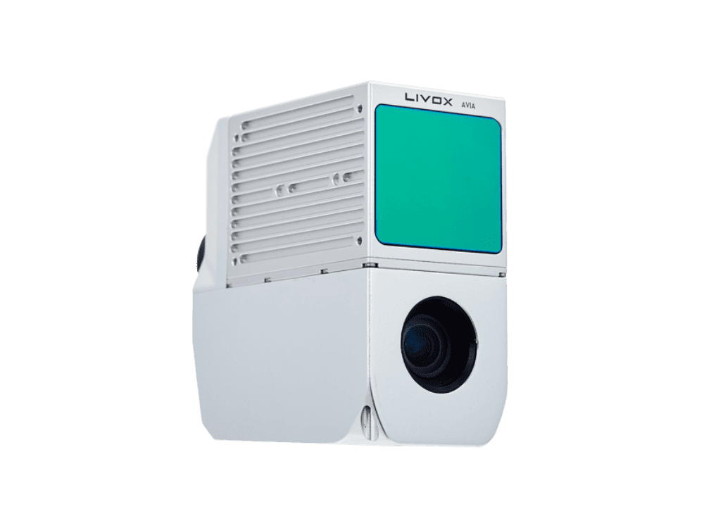
AlphaAir 450
AA450: Airborne LIDAR system with built-in IMU, GNSS, 3D scanner, and camera
ADVANCED ACCURACY
High accuracy INS is essential to collecting quality LiDAR data, because without it, point cloud would be nothing more than an arbitrary collection of points. It allows the AA450 to provide an absolute accuracy of 5 to 10 cm. With advanced calibration and point cloud optimization technology, the thickness (range noise) of the point cloud is only 30% compared to similar products, which effectively improves the precision of the collected data.
EFFICIENT SCANNING
Users will obtain a long-range scanning up to 450 m with a high point's density on the measured surface. At a flying height of 100 m and a velocity of 5 m/s, the AlphaAir 450 (AA450) can deliver around 280 pts/m2 density. The built-in 26 MP high resolution camera has the same FOV width as the Livox LiDAR to provide complete point cloud coverage by RGB colorization.
FLEXIBLE INTEGRATION
AlphaAir 450 is ready for direct connection to a DJI M300 via its integrated Skyport. Moreover, it can be installed on CHCNAV's BB4, other multirotor and VTOL UAVs easily. Finally, it can be fitted on any multirotor and fixed wing VTOL drones that can support its weight with dedicated mounts to attach it.
LIGHTEST UNIT IN ITS CLASS
The design of the AlphaAir 450 continues to follow the rule - the lighter the unit, the higher the productivity, as the drone can fly longer. As an example, the DJI M300 with the AlphaAir 450 can fly for 30 minutes and collect data covering an area of 2 km2. If users choose the CHCNAV’s BB4 UAV, its endurance with the AlphaAir 450 will reach 55 minutes.
3D POINT CLOUD PROCESSING SOFTWARE
CoPre is an advanced, user-friendly 3D laser scanning pre-processing software that can process captured raw data, including POS trajectories, LiDAR data, and RGB images. CoProcess is a reality capture post-processing software providing DEM/DTM generation, semi-automated feature extraction, automatic data classification, and dedicated power line and road inspection modules. With its intuitive interface and efficient workflow, the software significantly improves the productivity of 3D mapping projects.
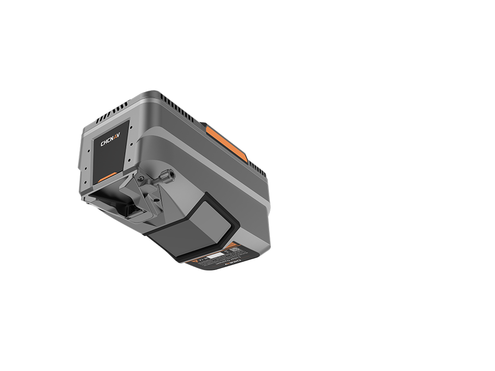
AlphaAir 15
The AlphaAir 15 (AA15) is a lightweight LIDAR system with long-range scanning, high accuracy, and fast data acquisition. It excels in capturing high-density data, especially in challenging terrains and mountainous regions.
HIGH-PRECISION POINT CLOUD GENERATION
Utilizing CHCNAV's patented tilted-prism technology, the AA15 delivers 15 mm linear accuracy on long-range scans up to 150 meters. This innovative technology supports echo digitization and online waveform processing. With a continuously rotating polygon mirror, the AA15 achieves scan speeds of up to 600 lines per second, combined with 2 million pulses per second, resulting in high-density point clouds that recreate the world with remarkable precision.
PREMIUM QUALITY IMAGES COLLECTION
The AA15 supports several external camera accessories for high-resolution imaging needs, including CHCNAV's 45 or 61 MP full-frame calibrated cameras and a 130 MP half-frame oblique camera. Users can also integrate cameras from third-party oblique or ortho-camera manufacturers. The combination of high-density point clouds and high-resolution imagery facilitates rapid mesh model construction and provides detailed texture information.
ADVANCED VEGETATION PENETRATION
The AA15 excels in vegetation penetration thanks to its advanced multi-target capability that supports up to 16 returns per laser pulse and 7 multi-period zone processing. With a high point frequency of 2 million pulses per second, the AA15 increases the probability of laser penetration through vegetation, making it easier to obtain more ground points.
DIVERSE AIRBORNE PLATFORM COMPATIBILITY
Featuring CHCNAV's unified Alphaport interface, the AA15 allows quick and easy connection to power sources and cameras with a single click. Its compact design and light weight of only 2.5 kg ensure seamless integration into various UAS, UAVs, RPAS, small manned aircraft, and helicopters.
EFFICIENT SURVEYING OF LARGE AREAS
Capturing 2 million points per second and with a maximum range of 1800 meters, the AA15 can be mounted on a variety of platforms. With a flying height of up to 700 meters, it provides minimal point loss over large areas, making it ideal for high-point density corridor mapping applications such as power lines, highways, railroads, and pipeline inspections. It is also well-suited for urban mapping projects.
COMPREHENSIVE GEOSPATIAL ECOSYSTEM
The CHCNAV ecosystem is tailored for your convenience, providing a complete solution for integrating LiDAR technology into your geospatial services. The SmartGo App automates reality capture and offers real-time mission monitoring, while the CoPre and CoProcess software suite simplifies post-processing and feature extraction. This user-centric approach ensures a smooth data workflow, improving work efficiency and productivity.
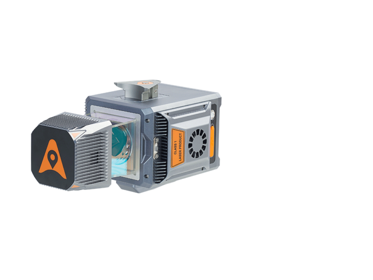
AlphaUni 20
The multi-platform high-end lidar solution for mapping & geospatial
OUTSTANDING ACCURACY
The AlphaUni 20 (or AU20) delivers precise accuracy through CHCNAV's high-precision navigation algorithm and a scanner with 5 mm repeated range accuracy, resulting in exceptional absolute accuracy of 2 to 5 cm, even in challenging environments. Its long-range scanning capabilities reach up to 1450 m, while high-speed measuring at 2M points per second is enabled by a 200 Hz continuously rotating mirror. The AU20 provides enhanced detail for all critical surveying tasks. In addition, the newly developed SLAM algorithm will improve trajectory accuracy in a challenging environment.
STRONG VEGETATION PENETRATION
The AU20's advanced multi-target capability supports up to 16 target returns, enhancing its ability to penetrate vegetation. Capturing ground surfaces and generating accurate Digital Elevation Models (DEMs) and Digital Surface Models (DSMs) is effortless, even in challenging environments with dense vegetation. Installing the AU20 on aerial survey drones is fast and easy, thanks to Alpha port’s one-click connection to the power source and camera.
RELIABILITY AND SIMPLIFIED WORKFLOW
The AU20 offers unparalleled levels of protection and operational performance in any field environment. Surveying missions can encounter unexpected weather or site conditions, but the AU20 is designed to outperform in all circumstances, ensuring consistent and reliable performance. The SmartGo software provides fully automated reality capture and real-time mission monitoring, and CoPre desktop software performs intelligent point cloud processing and data fusion.
LIGHTWEIGHT MULTI-PLATFORM DESIGN
The AU20 LiDAR is light and compact, weighing just 2.82 kg. Combined with its car mount kit, including a Ladybug5+ and SLAM technology, the total weight is only 10.7kg. With its flexible multi-platform design, the AU20 can be easily mounted on manned and unmanned aircraft for airborne scanning. In addition, it can be seamlessly integrated into a variety of land vehicles, such as cars, boats, and trains, for mobile mapping applications. The AU20 can also be mounted on a backpack for narrow-area mapping providing unparalleled versatility.
AlphaAir 10
Professional Airborne LiDAR + RGB System
PRECISION AND ADVANCED SCANNING CAPABILITIES
The AlphaAir 10’s (or AA10) high-precision navigation algorithm, in conjunction with the CHCNAV scanner, provides 5 mm repeated range accuracy and achieves exceptional absolute precision in the 2 to 5 cm range, even in complex environments. With the capability of long-range measurements up to 800 m, rapid scanning at 500,000 points per second, and a continuously rotating mirror that enables scanning speeds of 250 scans per second, the AA10 enhances the detail of aerial mapping operations.
SEAMLESS DATA FUSION AND REAL-TIME DATA VIEW
The AA10 accelerates mesh model creation by generating high-quality point clouds using a 45 MP camera for detailed image mapping and realistic colorization. It supports automated reality capture and real-time data visualization, aiding decision-making during surveys. The CoPre and CoProcess software suite further streamlines post-processing with an efficient data workflow.
ENHANCED VEGETATION PENETRATION
Leveraging advanced multi-target capabilities, the AA10 features up to 8 target echoes, enhancing its ability to penetrate dense vegetation. This feature allows the system to effectively acquire ground surfaces, resulting in accurate Digital Elevation Models (DEMs) and Digital Surface Models (DSMs), even in challenging environments with dense vegetation.
EFFICIENT DESIGN AND ROBUSTNESS
The AA10 LiDAR system is impressively lightweight and compact, weighing just 1.55 kg, and provides a 30-minute operating time when integrated with drones such as the DJI M350. The installation process is simplified with AlphaPort's convenient one-click connection to the UAV's power source. The AA10 is also IP64-rated to ensure the system's resilience, allowing it to deliver consistent, reliable performance in varying operating conditions.
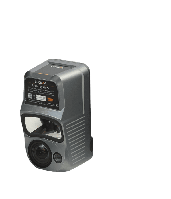
AlphaAir 1400
Premium airbone laser scanner with 1430 m range for high-density corridor LiDar mapping applications
OUTSTANDING ACCURACY SCANNING
The AlphaAir 1400 provides a survey-grade accuracy of 2 to 5 cm, with the operating flight altitude of up to 720 m by combining industrial-grade CHCNAV’s GNSS and high precision IMU systems. The integrated VUX-120 features a wide 100-degree field of view and a high-speed data acquisition rate of up to 1.8 MHz with a scanning range of up to 1430 m delivering 1 cm linear accuracy. The continuously rotating polygon mirror wheel enables scan speeds of up to 400 lines per second, perfectly suited for the fixed-wing UAV corridor mapping applications.
THREE-DIRECTION SCANNING SYSTEM
The AA1400 enables data acquisition with unrivaled completeness, especially in challenging environments with vertical surfaces and narrow canyons. In addition, it significantly reduces field operation time by minimizing laser shadowing and provides geometry on complex vertical structures in a single pass. In addition, the ability to integrate external cameras - DSLR, thermal or multispectral, empowers an unlimited number of applications.
CABLE-FREE CONNECTION
In one click connect the AlphaPort to the power source; in the second click, start the LiDAR. The AA1400 eliminates the need for additional accessories and time for camera calibration. The AlphaAir1400 can be installed with increased protection against potential damage on the wide range of unmanned aerial vehicles.
LIGHTEST UNIT IN ITS CLASS
The AlphaAir 1400 is a compact unit with an embedded remote control system and 1TB of internal data storage capacity. It is designed to take aerial drone surveying missions to the next level - to conduct safe operations at higher flight altitudes and cover larger areas per flight than usually achievable.
COMPREHENSIVE ECOSYSTEM
The CHCNAV software package allows a complete LiDAR solution to be added to the users' geomatic services. Fully automated reality capture and real-time mission tracking are performed with CoCapture UAV software and semi-automatic point cloud processing using CoPre desktop software.
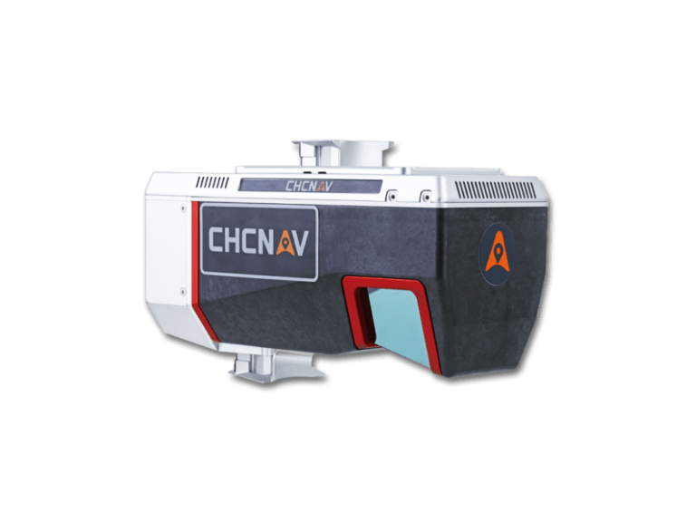
AlphaAir 2400
Premium airborne laser scanner with 2 150 m range for high-altitude LIDAR mapping over large areas
DATA ACQUISITION AT HIGH ALTITUDE
The AlphaAir2400 with the extended scanning range, allows higher altitude missions of up to 1400 m, to survey large areas and avoid potential collisions with high objects. The acquisition time is significantly reduced, especially for large corridor mapping projects from helicopters or aircraft. With its integrated VUX-240, the AA2400 features a wide 75-degree field of view and a high-speed data acquisition rate of up to 1.8 MHz with a scanning range of up to 2150 m at 80% albedo delivering 2 cm linear accuracy.
PROFESSIONAL IMAGING SENSORS
Up to four cameras in nadir or nadir and oblique view with a high resolution of 100-150 MP, such as a PhaseOne camera, can be added to the AA2400. By obtaining high resolution geo-referenced and/or oblique imagery, more applications can be supported increasing the return on investment for the client.
EXTREME PRODUCTIVITY AND DATA QUALITY
The built-in VUX-240 LiDAR delivers 2 cm linear accuracy on long-range scans. The continuously rotating polygonal mirror wheel enables scan speeds of up to 400 lines per second, ideally suited for high point density corridor mapping applications. The over-density of accurate data makes the results of point cloud processing, such as drawings, 3D models, or DTMs, more accurate.
EASY INSTALLATION AND OPERATION
The AlphaAir 2400 is easy to install; one click connects the AlphaPort to the power source; a second click starts the LiDAR. The AA2400 eliminates the need for additional accessories and camera calibration time. It can be installed with increased protection against potential damage on various airborne platforms and operated from up to 8 km range with its embedded remote control system.
COMPREHENSIVE ECOSYSTEM
The software package developed by CHCNAV allows a complete LiDAR solution to be added to the users' geomatic services. Fully automated reality capture and real-time mission tracking are performed with CoCapture UAV software and semi-automatic point cloud processing using CoPre desktop software.
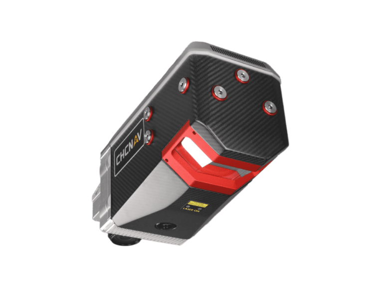
Alpha3D
Advanced mobile mapping solution for
3D mass data acquisition.
PREMIUM HIGH PERFORMANCE LASER SCANNER
Provide high-speed scanning of 1.8 million points per second, high point cloud density even at fast driving speed and extreme quality point cloud with low range noise.
HIGH RESOLUTION 360° IMAGES
Support fully calibrated point clouds and panorama images. You can add additional imagery sensors to get extra information whenever your application needs.
READY NOW TO ANTICIPATE FUTURE
Provide two RS232 ports for external device connection, 2nd GNSS antenna to work on railway or water applications, and an easy-in easy-out SSD hard disc for faster data transfer.
VEHICLE INDEPENDENT PLATFORM
Whatever the task is, the Alpha3D rapidly and efficiently collects high density, accurate point clouds and powerful images data, but also adds extra information from additional sensors, such as high-resolution camera, thermal camera, GPR, echo-sounder or extra profiler.
3D POINT CLOUD PROCESSING SOFTWARE
CoPre is an advanced, user-friendly 3D laser scanning pre-processing software that can process captured raw data, including POS trajectories, LiDAR data, and RGB images. CoProcess is a reality capture post-processing software providing DEM/DTM generation, semi-automated feature extraction, automatic data classification, and dedicated power line and road inspection modules. With its intuitive interface and efficient workflow, the software significantly improves the productivity of 3D mapping projects.
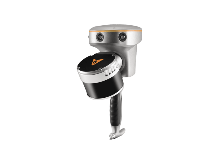
AlphaUni 300
The most flexible and accurate LIDAR |
solutions with miniVUX UAV familyor
CHCNAV technology onboard. |
ONE OF THE LIGHTEST UNIT IN ITS CLASS
LiDAR weight is a constraint for any drone. The drone needs to lift the entire payload, if not, no data acquisition is possible! The lighter the unit, the higher the productivity, because your UAV can fly longer.
HIGH DATA QUALITY
Users can select either the miniVUX series AU300 or the self-designed CHCNAV AU20 for higher data density. Equipped with industry-leading GNSS and IMU sensors, the AlphaUni 20 & 300 provide the best combination of point cloud density, precision, and survey-grade accuracy.
INTELLIGENT FLEXIBILITY
Within 5 minutes, the AlphaUni can be mounted on various platforms, including different models of UAVs, fixed-wing and multi-rotor VTOLs UAS, vehicles, backpacks, USVs and boats, enabling data collection in the most challenging environments.
EXTREME PRODUCTIVITY
Equipped with a unique 8 km UHF data transmission, the parameters of AlphaUni 300 can be set remotely. The operating status of the system can be observed wirelessly in real time, reducing mission preparation time and improving operational efficiency.
3D POINT CLOUD PROCESSING SOFTWARE
CoPre is an advanced, user-friendly 3D laser scanning pre-processing software that can process captured raw data, including POS trajectories, LiDAR data, and RGB images. CoProcess is a reality capture post-processing software providing DEM/DTM generation, semi-automated feature extraction, automatic data classification, and dedicated power line and road inspection modules. With its intuitive interface and efficient workflow, the software significantly improves the productivity of 3D mapping projects.
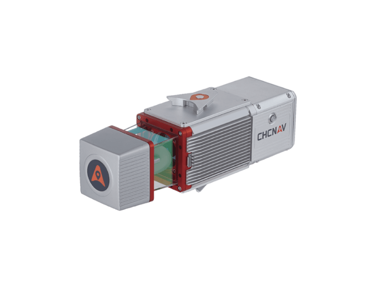
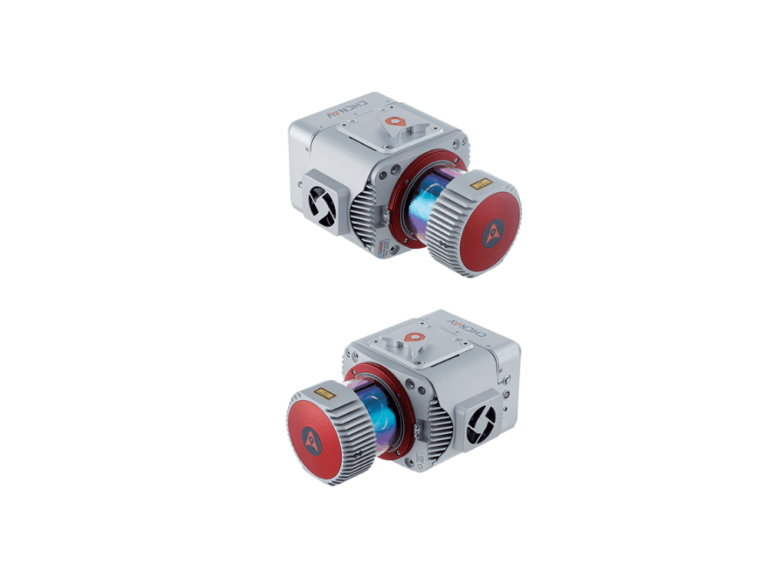
AlphaUni 900/1300
Long-range high-end LiDAR solutions,
providing most universal installation.
SURVEY-GRADE ACCURACY TOGETHER WITH LONG-RANGE CAPABILITY
With Riegl's premium VUX-1 UAV and VUX-1 LR high-speed, long-range scanners, combined with industry-leading GNSS and IMU sensors, the AlphaUni900 and AlphaUni1300 are designed for the most demanding mapping applications where accuracy, high speeds and altitudes over large scan regions are a must.
GREATEST FLEXIBILITY
In only 5 minutes set-up time the AlphaUni 900 allows users to capture reality from multiple platforms, including different UAV models, multi-rotor and fixed-wing VTOL UAS, and then switch to vehicle mode for highway measurements and high-precision maps with our advanced kit with panoramic camera or quickly switch to backpack mode when the UAV and vehicle are unable to complete the mission.
CONNECTIVITY
For multi-platform installation, the AlphaUni 900 & 1300 have different connection ports and support additional synchronization with DMI, GAMS (dual GNSS antenna), different cameras and other devices that support NMEA.
3D POINT CLOUD PROCESSING SOFTWARE
CoPre is an advanced, user-friendly 3D laser scanning pre-processing software that can process captured raw data, including POS trajectories, LiDAR data, and RGB images. CoProcess is a reality capture post-processing software providing DEM/DTM generation, semi-automated feature extraction, automatic data classification, and dedicated power line and road inspection modules. With its intuitive interface and efficient workflow, the software significantly improves the productivity of 3D mapping projects.
3D POINT CLOUD PROCESSING SOFTWARE
CoPre is an advanced, user-friendly 3D laser scanning pre-processing software that can process captured raw data, including POS trajectories, LiDAR data, and RGB images. CoProcess is a reality capture post-processing software providing DEM/DTM generation, semi-automated feature extraction, automatic data classification, and dedicated power line and road inspection modules. With its intuitive interface and efficient workflow, the software significantly improves the productivity of 3D mapping projects.
e-Newsletter
Sign up for our newsletter to stay updated on the latest innovations, product launches, insightful case studies, and exclusive event invitations.
CONTACT US
- [email protected]
- +61 730 400 587
- Australia
Explore
- Our Services
- Products
- About Us
company
- Support
- Distributions
- Case Study
help center
- Contact
- Feedback