
Software

CoPre LiDAR Processing Software
An advanced, user-friendly 3D laser
scanning data processing software to
process captured raw data, including
POS trajectories, LIDAR data and RGB
images.
SUPPORT ALL CHCNAV's LiDAR SCANNERS
CoPre desktop software provides instant access to raw data from all the CHCNAV LiDAR systems. Whether you want to process data from the compact AlphaAir 10 mobile mapper for UAVs, perform massive data processing from the vehicle-mounted AlphaPano or Alpha3D system, or get the results of your corridor mapping project with the AlphaUni 20 or AlphaAir 2400 on a helicopter, CoPre supports all your mapping scenarios.
EXTREME LIDAR DATA QUALITY
For experts searching to optimize their data quality further, CoPre features an advanced processing mode. It handles the layering problems of multiple point clouds and improves relative accuracy through an efficient strip adjustment algorithm. Additional use of ground control points (GCP) is available to improve the absolute accuracy of the point cloud. The advanced calibration and optimization technology results in a point cloud thickness that is 30% less than similar products provided on the market.
COMPREHENSIVE PRE-PROCESSING WORKFLOW
All LiDAR data processing starts with the first and foremost step of trajectory generation. CoPre is powered by the accurate and efficient algorithm developed by CHCNAV to process captured raw data, including trajectory (POS) files, LiDAR data, and RGB images. Multiple data sets can be processed simultaneously to increase workflow efficiency, solving the problem for SLAM-based units of updating a map of an unknown environment while simultaneously keeping track of the location within it.
EFFICIENT LASER SCANNER DATA ANALYSIS
CoPre includes different powerful options to check the data after the processing steps. It supports massive data set visualization with multiple colorization options. Its automatic trajectory slicing and stratification checking allow quick detection of misalignments across the entire data set. Elevation accuracy can be automatically verified by importing elevation control points. Multiple accuracy reports are available to address quality control requirements.
AUTOMATED PROCESSING
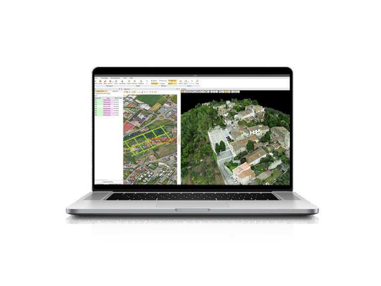
CHCNAV's solutions leverage extensive mobile mapping data collection expertise to guarantee efficient data processing. CoPre enables automated point cloud processing, image georeferencing, point cloud colorization, depth maps, and one-click results output.
ADVANCED RECONSTRUCTION MODULE
Users can take full advantage of CHCNAV LiDAR airborne data capture thanks to the CoPre reconstruction module, which supports the aerial triangulation process and allows the final digital orthophoto and 3D mesh module output to be exported without the need for additional software. The DOM generation and modeling algorithm in CoPre also enables the combination of photos and point clouds captured simultaneously by CHCNAV LiDARs to rapidly export a high-quality orthophoto or 3D model for in-field verification.
CoProcess
The CoProcess is a reality capture post-
processing software providing
DEM/DTM generation, semi-automated
feature extraction, automatic data
classification, and dedicated power line
and road inspection modules. With its
intuitive interface and efficient workflow,
the software significantly improves the
productivity of 3D mapping projects.
MASSIVE DATA CLASSIFICATION
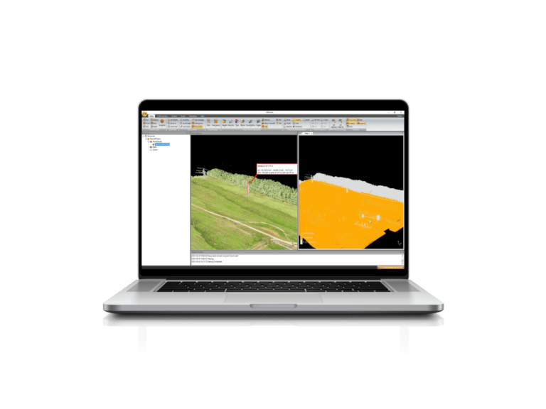
CoProcess uses advanced CHCNAV algorithms to automatically and manually classify point cloud data into various categories, including ground, vegetation, buildings, roads, power lines, and others. This classification process allows for the efficient and accurate extraction of valuable information from the point cloud data, such as creating 3D models of buildings, mapping vegetation coverage, and identifying potential obstacles for infrastructure planning and maintenance.
AUTOMATIC DEM/DSM GENERATION
CoProcess is a comprehensive software solution for generating DEMs or DSMs from point cloud data, from the initial field data collection to the final rendering. The process includes a specialized algorithm for efficient measurement noise filtering, automatic ground point filtering, and seamless DEM/DSM data export based on the required configuration. In addition, CoProcess provides various editing functions to further enhance the quality of the DEM/DSM data.
POWERFUL FEATURE EXTRACTION
CoProcess's robust feature extraction module supports both automatic and manual extraction of road features. Extracted features can be easily converted to DAT and DXF formats for seamless integration with software such as AutoCAD and ArcGIS, significantly improving work efficiency and productivity compared to traditional survey methods.
VOLUME CALCULATION AND ANALYSIS
CoProcess supports volume calculation from point clouds using the grid method, with results that can be easily exported in DXF format. It also facilitates the analysis of volume differences between successive LiDAR data sets, providing detailed reports for informed decision-making
USER-FRIENDLY INTERFACE DESIGN
CoProcess has an intuitive user interface with four main modules: Foundation, Terrain, Road, and Volume. The CoData point cloud format enhances the user experience when importing and visualizing large datasets. The interface and module layout are customizable to suit the user's preferred work habits. With an integrated workflow wizard and user manual, CoProcess is easy to learn and master, making it an effective tool for even new users.
e-Newsletter
Sign up for our newsletter to stay updated on the latest innovations, product launches, insightful case studies, and exclusive event invitations.
CONTACT US
- [email protected]
- +61 730 400 587
- Australia
Explore
- Our Services
- Products
- About Us
company
- Support
- Distributions
- Case Study
help center
- Contact
- Feedback