UAS Cameras

C5 & C30 AERIAL SURVEY CAMERAS
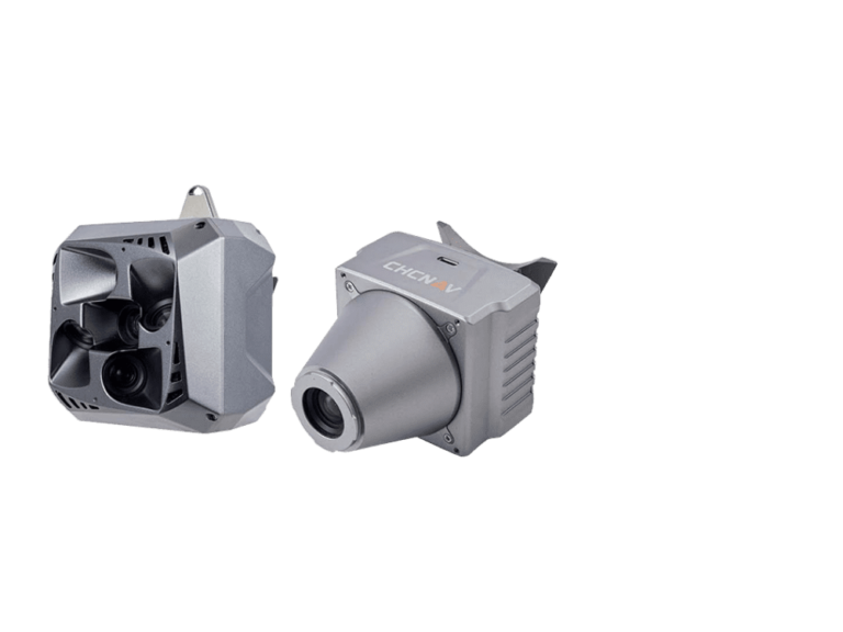
The C5 & C30 Orthographic & Oblique Cameras for Aerial Surveys are Designed to Provide High-Quality Imaging Solutions for Photogrammetric Applications and to Complement Lidar Survey Data
LIGHTWEIGHT & SMALL SIZE
The C5 camera is a highly efficient and lightweight system for aerial surveys, weighing only about 290 grams for increased flight endurance. Its compact size of 75 x 63.5 x 102.5 mm allows easy integration into UAVs. The C30 camera's weight is about 600 grams with a size of 110x108x85 mm, and it is the smallest and lightest industry-grade camera that can be mounted on most UAVs. The advanced and lightweight design of both cameras matches the mounting requirements of various UAVs available on the market and ensures it does not impact the drone's performance or maneuverability.
UNIVERSAL INSTALLATION
The C5 and C30 cameras' universal installation design makes them compatible with a wide range of fixed-wing and rotor UAV platforms. Both cameras are supported by the CHCNAV’s BB4 Mini and P330 Pro drones as well as the DJI’s M300 RTK. The Alphaport (the A-type hardware interface) allows the C5 and C30 to be easily mounted into various UAVs and converted into the DJI Skyport connector for extended compatibility.
INTEGRATED QUICK-RELEASE INTERFACE
Aplhaport provides a speedy and secure way to install and disconnect cameras to and from UAVs without additional tools or complicated procedures. In addition, Alphaport includes power and data communications, reducing wiring and connections' complexity. As a result, a more efficient and productive workflow that ensures the camera remains stable and secure even in challenging weather conditions is achieved.
PLUG-IN MEMORY CARD
Specific high-speed data transfer options are available from the C5 and C30 cameras to ensure efficient and reliable access to your data. The C5 camera features 256 GB internal memory with a transfer rate of up to 80 Mb/s via a USB-C connection. The C30 camera comes with a 640 GB plug-in memory card for fast copy speeds of up to 300 Mb/s and easy transfer of images directly from the memory card to your computer. With the C5 and C30 cameras, large amounts of data can be transferred quickly and easily without performance issues.
SUPPORT FOR USE WITH CHCNAV LIDARS
The C5 and C30 cameras give maximum flexibility for photogrammetric applications. They can be used independently on RTK-enabled drones to capture high-resolution imagery or installed directly on the CHCNAV's LiDAR series to colorize point cloud data. This feature allows seamless imagery and LiDAR data integration for a more complete view of the surveyed area.
EFFICIENT WORKFLOW
The CHCNAV's comprehensive portfolio of LiDAR and aerial camera solutions enable users to develop their geomatics services further. The CHCNAV's CoPre software is an integrated field-to-finish solution for processing aerial imagery and LiDAR data captured in a single flight. With CoPre, large volumes of data can be efficiently processed and analyzed, generating accurate and actionable insights in less time.
e-Newsletter
Sign up for our newsletter to stay updated on the latest innovations, product launches, insightful case studies, and exclusive event invitations.
CONTACT US
- [email protected]
- +61 730 400 587
- Australia
Explore
- Our Services
- Products
- About Us
company
- Support
- Distributions
- Case Study
help center
- Contact
- Feedback