Mapping & Geospatial
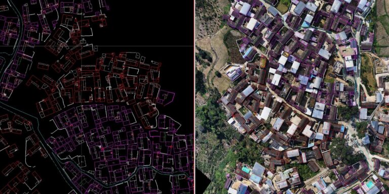
We specialize in drone image processing, providing precise and fast analysis. Our team utilizes advanced software and techniques to extract valuable insights from aerial imagery, ensuring high accuracy and quick turnaround times. Rely on us for all your drone data processing needs to enhance your project's success
Advanced Geospatial Mapping Services
- Precision Mapping: Utilizing the latest GIS and remote sensing technologies for accurate geospatial data.
- Custom Solutions: Tailored mapping solutions to meet the unique needs of your project.
- Real-Time Data: Access to real-time geospatial data for informed decision-making.
Comprehensive GIS Analysis & Solutions
- Data Integration: Combining diverse data sources into a unified GIS platform for enhanced analysis.
- Spatial Analysis: In-depth spatial analysis to reveal patterns, trends, and insights.
- Visualization Tools: Interactive maps and visualizations to communicate complex data effectively.
Drone-Based Aerial Mapping & Surveying
- High-Resolution Imagery: Capturing detailed aerial imagery with drone technology.
- Efficient Coverage: Rapid surveying of large areas with unmatched precision.
- 3D Modeling: Creating accurate 3D models of terrain and structures for enhanced planning.
Geospatial Data Management & Consulting
- Data Storage Solutions: Secure and scalable geospatial data storage and management.
- Custom Consulting: Expert consulting to optimize your geospatial data use.
- Data Accuracy: Ensuring high accuracy and reliability in all geospatial data collected.
e-Newsletter
Sign up for our newsletter to stay updated on the latest innovations, product launches, insightful case studies, and exclusive event invitations.
CONTACT US
- [email protected]
- +61 730 400 587
- Australia
Explore
- Our Services
- Products
- About Us
company
- Support
- Distributions
- Case Study
help center
- Contact
- Feedback
