About DroneWays
Year of Experiences
0
+
Customer Satisfaction
0
%
Team
0
+
Projects
0
+
Our Approach:
At DroneWays, we prioritize precision, innovation, and collaboration, beginning with a deep understanding of your unique goals to deliver tailored drone solutions. We utilize cutting-edge technology and advanced sensors to ensure the highest quality service, while maintaining strict adherence to safety protocols and regulations.
Our approach focuses on transforming collected data into actionable insights, empowering you to make informed decisions. We are committed to sustainability and dedicated to providing ongoing support, ensuring you continue to benefit from our services long after project completion.
")
Our Mission:
We aim to become a hallmark of the sky. The design and functionality of our products are centered on safety. By offering an aerial perspective, we help companies and individuals gain a clear view of every aspect of their sites and events.
This enables them to make informed decisions and overcome obstacles that may compromise safety. DroneWays provides services across various industries, helping individuals and businesses meet their needs. We are a team of experts who combine cutting-edge technology with passion to deliver versatile services and products.
What we offer
Aerial cinematography and photography
Capturing stunning, high-resolution aerial photos and cinematic videos.
Aerial Photogrammetry and 3D modelling
Creating accurate 3D models from aerial images for precise spatial analysis.
Aerial mapping and surveying
Delivering detailed maps and topographic data with drone-enabled technology.
Video editing related to drone footage provided
Professional editing services for drone-captured videos, tailored to your needs.
Aerial drone services in emergency situations
Locating missing persons and assisting emergency responses with aerial drones.
Industrial and Asset Inspection
Conducting safe, detailed inspections of industrial sites and critical assets.
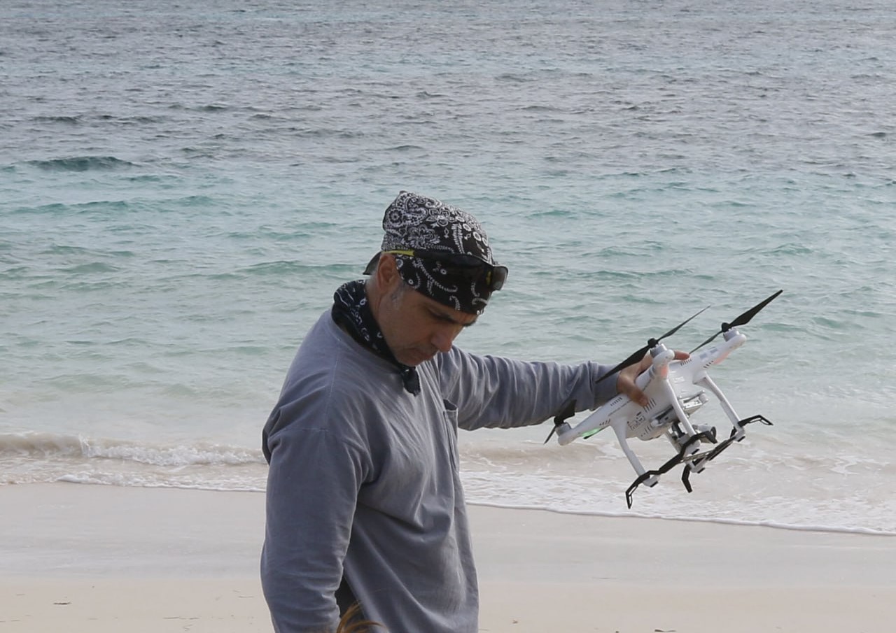
FRANK GAVIANO
DRONE PILOT
Frank, Chief Pilot and Licenced Drone Operator, is a former pilot and owns a successful media production agency based in Australia.
His passion for flying airplanes and filmmaking have led him to develop a strong interest in drone services. Frank has got over seventeenth years of experience in the drone industry, including recent international projects in South East Asia.
He provides his drone services all over the Australia, utilising cutting edge with advanced drones and LiDAR combined with AI technologies.
Anshuman Paul
CERTIFIED DRONE PILOT
Anshuman, Certified drone pilot specializing in aerial photography, videography, surveying, and inspections. With a strong focus on precision, safety, and efficiency, I provide high-quality aerial solutions for various industries. Utilizing advanced drone technology, I ensure accurate data collection and exceptional visual content. Committed to professionalism and regulatory compliance, I deliver reliable and innovative drone services tailored to meet diverse project requirements.
Jon Caris
SENIOR DRONE DATA SCIENTIST
Jon is the Senior Drone Data Scientist at Tufts University in Massachusetts, where he advances teaching and research with drone technology. As the founding Director of the Spatial Analysis Lab at Smith College, he built its drone program and led research trips to locations including Maine, Georgia, The Bahamas, and Belize.An FAA-certified Drone Pilot and experienced GIS Analyst (GISP), Jon is skilled in mapping, spatial analysis, 3D modeling, and conservation. His work emphasizes ethical applications of drone technology and its use in education, research, and wildlife preservation.
SAMUEL OGAGA
MARKETING & LOGISTICS MANAGER
Samuel, Marketing and Logistics Manager at DroneWays, brings years of experience in managing operations and leading marketing initiatives. With a background in logistics and a passion for drone technology, Samuel has been instrumental in expanding DroneWays’ footprint in the industry. Overseeing everything from client relations to campaign strategies, Samuel ensures smooth operations while utilizing innovative solutions to drive growth. He is dedicated to advancing DroneWays mission of delivering top-tier drone services.
Manuel Orsi
DRONE MAPPING SPECIALIST
Manuel Orsi is a Civil Engineer and Drone Mapping Specialist based in Australia, combining advanced photogrammetry with engineering expertise to support infrastructure, restoration, and real estate projects. With years of experience in drone-based surveying and geospatial analysis, Manuel delivers high-precision orthomosaics, 3D models, and CAD outputs for clients across the public and private sectors.
e-Newsletter
Sign up for our newsletter to stay updated on the latest innovations, product launches, insightful case studies, and exclusive event invitations.
CONTACT US
- [email protected]
- +61 730 400 587
- Australia
Explore
- Our Services
- Products
- About Us
company
- Support
- Distributions
- Case Study
help center
- Contact
- Feedback