GNSS Smart Antennas

i93 Visual IMU-RTK GNSS
The i93 is a highly versatile receiver that combines cutting-edge GNSS, Auto- IMU, RTK, and dual-camera technologies. It utilizes the iStar GNSS RTK algorithm, multi-band GNSS channels, and a hybrid engine to achieve precise positioning and surveying under challenging environments.
1408 CHANNELS, iSTAR AND HYBRID ENGINE
The i93 offers all essential connectivity features for surveyors, including built-in Wi-Fi, Bluetooth, NFC, and integrated 4G and UHF modems, supporting various GNSS survey modes. With smart power management, it operates for up to 34 hours as a GNSS RTK network rover without the need for spare batteries. Its magnesium alloy body is shock, dust, and water-resistant, ensuring reliable performance in any environment.
FAST, RELIABLE INDUSTRIAL AUTO-IMU
The i93 GNSS features CHCNAV's advanced 200Hz Auto-IMU technology, which eliminates the need for manual setup and simplifies field operations. Its IMU-RTK automatic pole tilt compensation allows for accurate surveying even with the pole tilted up to 60 degrees, improving efficiency by up to 30%. This makes the i93 an ideal solution for engineers, site managers, and surveyors looking for fast, accurate, and productive surveying and mapping.
VISUAL NAVIGATION AND STAKEOUT
The i93 features star-level cameras for an immersive 3D visual navigation and stakeout experience. With LandStar software, surveyors are guided by a clear directional arrow and real-time distance markers, simplifying stakeout operations. The 3D visual capabilities also support line and CAD-based map stakeouts, making tasks more intuitive and efficient. This system enhances the stakeout process, enabling quick completion and improving efficiency by up to 50%, particularly for less experienced operators.
ENGINEERED FOR VERSATILE FIELD USE
The i93 offers all essential connectivity features for surveyors, including built-in Wi-Fi, Bluetooth, NFC, and integrated 4G and UHF modems, supporting various GNSS survey modes. With smart power management, it operates for up to 34 hours as a GNSS RTK network rover without the need for spare batteries. Its magnesium alloy body is shock, dust, and water-resistant, ensuring reliable performance in any environment.
VISUAL SURVEY AND 3D MODELING
The i93 is an advanced surveying tool that integrates GNSS, IMU, and dual global shutter cameras with video photogrammetry. It quickly delivers survey-grade 3D coordinates from video capture, making it ideal for hard-to-reach, obstructed, or hazardous locations like underpasses and near power poles. Its dynamic video capture, automatic image matching, and high-speed continuous shooting boost productivity by up to 60%, ensuring fast and accurate results. The i93 is perfect for surveyors seeking efficiency, speed, and precision.
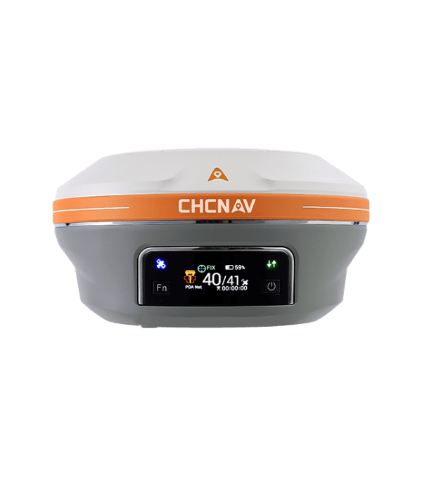

i89 POCKET-SIZED Visual IMU-RTK GNSS
The i89 is a compact, high-performance
receiver that integrates the latest |
GNSS, Auto-IMU, RTK, and dual
camera technologies in a 750g design
for intensive daily use.
iSTAR 2.0 & IONOSPHERE MITIGATION
The i89 GNSS offers exceptional performance with 1408 channels and an integrated SoC for full constellation tracking. Advanced algorithms boost fix rates by 15%, even in challenging environments, while iStar2.0 and ionospheric interference rejection technology deliver a 96% reliable fix rate, ideal for regions with high ionospheric activity. Its narrow-band multipath mitigation and hybrid GNSS engine ensure highly accurate and reliable RTK measurements.
AUTO-IMU TECHNOLOGY
The i89’s 200 Hz Auto-IMU ensures interference-free, reliable measurements without manual initialization. Its automatic pole tilt compensation maintains 3 cm accuracy within a 60-degree tilt range, boosting efficiency by saving up to 30% of time.
AR NAVIGATION & STAKEOUT
The i89’s AR visual navigation and staking streamline field operations, reducing operator time by up to 50%, even for beginners. With integrated GNSS, IMU, and Visual systems, it’s 10 times more reliable than standard GNSS systems. Its 1.5 GHz processor allows smooth dual-camera functionality, while 5.8 GHz Wi-Fi ensures fast AR data transfer. The Virtual Pole Tip™ (VPT™) provides real-time point visualization on CAD designs, and versatile AR Stakeout supports applications such as linear, CAD-based, and boundary staking.
16.5H BATTERY LIFE & IP68 DESIGN
The i89 features a high-energy density battery that offers up to 16.5 hours of operation, with an 18W fast charge that fully recharges in just 3 hours, boosting efficiency and extending battery life. Weighing only 750g, its compact design integrates GNSS, IMU, and two cameras into a pocket-sized receiver, minimizing volume and height. It is IP68-rated and durable enough to withstand a 2-meter mast drop.
VISUAL SURVEY EXCELLENCE
The i89 enhances GNSS surveying by using vision-based technology to capture accurate measurements in areas with obstructed signals or limited access. Its advanced cameras provide survey-grade 3D coordinates from video, boosting efficiency and reliability. With a dynamic panoramic capture mode and 85% overlap, efficiency improves by 60%. The integration of high-precision IMU data into the video photogrammetry algorithm further enhances point measurement accuracy.
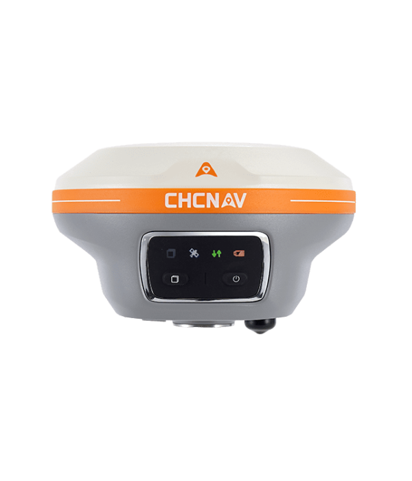

i83 PRO IMU-RTK GNSS
Smart IMU-RTK GNSS 336-channel
receiver that offers Trimble RTX and
OmniSTAR support, delivering RTK=
level accuracy without a base station or
VRS network.
SUPERIOR GNSS TECHNOLOGY
The i83 Pro GNSS smart antenna provides centimeter-level precision in seconds, maintaining consistent RTK accuracy even in challenging conditions. With a high gain antenna boosting satellite signal tracking efficiency by 30%, it ensures accurate, survey-grade positioning across multiple GNSS constellations. Integrated iStar technology enhances RTK surveying for superior performance in all applications.
COMPREHENSIVE CONNECTIVITY
The i83 Pro GNSS is a versatile, connectivity-driven solution for surveying projects. It features built-in Wi-Fi, Bluetooth, NFC, 4G, and UHF modems, supporting various GNSS surveying modes like RTK Networks and UHF base-rover setups. With continuous GNSS RTK corrections and support for VRS, FKP, MAC, and SSR messages, it delivers precise positioning. Its high-resolution display offers clear status updates, and the device can function as a UHF base station, data recorder, or network rover, giving surveyors full control of their operations.
ENHANCED AND VERSATILE FUNCTIONALITY
The i89 enhances GNSS surveying with vision-based technology, capturing accurate measurements even in obstructed areas. Its advanced cameras deliver survey-grade 3D coordinates from video, improving efficiency and reliability. The i83 Pro supports Trimble RTX and OmniSTAR for RTK-level accuracy without a base station, powered by the Trimble MAXPro Positioning Engine. Additional features like Fault Detection & Exclusion (FDE) and RAIM ensure high positioning quality in challenging environments, with flexible data rates for precision.
EFFICIENT IMU-RTK SURVEYING
The i83 Pro GNSS receiver’s built-in AUTO-IMU provides automatic pole tilt compensation, improving surveying, engineering, and mapping efficiency by up to 30%. Its 200 Hz inertial module ensures 3-centimeter accuracy in real time, even with pole tilts up to 60 degrees, making measurement and staking tasks faster and more productive for engineers, foremen, and surveyors.
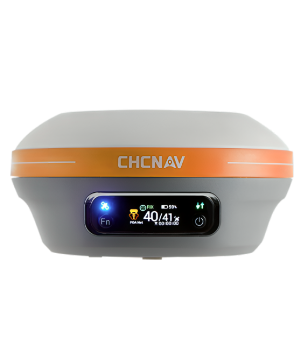

i83 IMU-RTK GNSS
Smart and versatile IMU-RTK GNSS
receiver for even more intuitive
surveying
BEYOND GNSS RTK SURVEY
The i83 GNSS smart antenna delivers centimeter-level precision within seconds and maintains reliable RTK accuracy, even in challenging environments. With a quick-start feature, it is ready for use within 30 seconds, speeding up point collection. Its third-generation high-gain antenna improves satellite signal tracking by 30%, ensuring accurate, survey-grade positioning across multiple constellations, including GPS, Glonass, BeiDou, Galileo, and QZSS. The integrated iStar technology optimizes GNSS RTK performance for all survey applications.
SMARTER CONNECTIVITY THAN EVER
The i83 GNSS offers built-in Wi-Fi, Bluetooth, NFC, 4G, and UHF modems for seamless GNSS surveying. It supports RTK Networks, UHF base-rover setups, and precise positioning in all scenarios. With a high-resolution display, it functions as a UHF RTK base station, network rover, or records data for post-processing, ensuring complete survey control.
ENGINEERED FOR FIELD USE
The i83 GNSS ultra-low-power SoC (System-on-Chip) features advanced power management that significantly extends GNSS survey duration, eliminating the need for spare batteries. It provides up to 34 hours of autonomous operation as a GNSS RTK network rover and 16 hours as an RTK base station. The i83 GNSS can be charged using a power bank or standard USB-C charger. Its magnesium alloy body is shockproof, dustproof, and waterproof, ensuring reliable performance in even the toughest job site conditions.
GNSS SURVEY TOOL FOR EVERYONE
The i83 GNSS features a built-in IMU for automatic pole tilt compensation, enhancing surveying, engineering, and mapping efficiency by up to 30%. It provides real-time, interference-free initialization of the 200 Hz inertial module in just 5 seconds, ensuring 3-centimeter accuracy even with pole tilts of up to 30 degrees. This makes measuring and staking out quick and straightforward, ideal for engineers, site foremen, and surveyors.
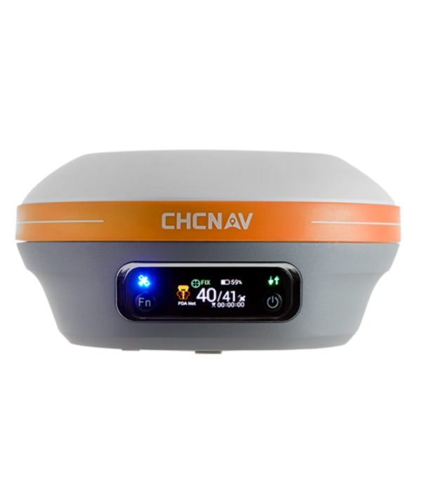

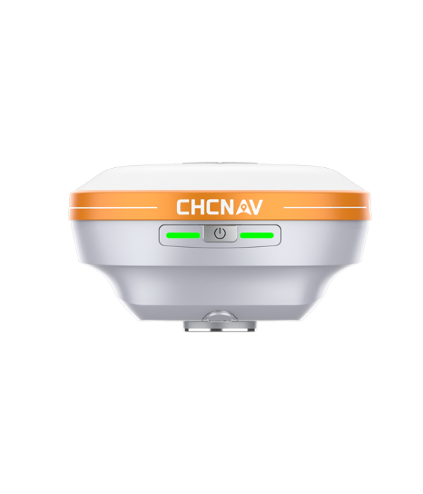
i76 PALM-SIZED Visual IMU-RTK GNSS
A lightweight tool with integrated GNSS,
IMU RTK, dual cameras, CAD+AR
visual stakeout, IP68 protection, and 2-
meter drop resistance for improved
efficiency in the field.
EFFICIENT CAD AR STAKEOUT
The i76 enhances construction stakeout efficiency by 40% over traditional surveying methods. It integrates CAD base maps with augmented reality (AR) and utilizes GNSS, IMU, and mixed reality (MR) technologies to provide an intuitive view of site layouts. This aids in path planning, reduces detours, and simplifies tasks such as pipeline direction anticipation and foundation building. The AR overlay is especially useful for redline reviews, centerline verifications, and optimizing stakeout operations across various construction scenarios.
AIR-MEDIUM ANTENNA & HYBRID GNSS ENGINE
The i76 GNSS is designed for challenging environments, featuring a 4th Gen air-medium GNSS antenna and a hybrid GNSS engine for robust tracking of all GNSS constellations and resistance to interference. With iStar 2.0 technology, it achieves an RTK fix rate exceeding 96%, making it suitable for areas with high ionospheric activity. When paired with CHCNAV base stations, it offers UHF coverage up to 25 km in standard conditions and 5-8 km in obstructed areas, ensuring reliable data across various surveying scenarios.
ULTRA-IMU TECHNOLOGY
The i76 features a 5th Gen interference-free Ultra IMU operating at 200 Hz, enhanced by EKF algorithms for precise measurements. It offers automatic pole tilt compensation, maintaining accuracy within 3 centimeters at a 60-degree tilt, ensuring reliable tilt measurements. The device simplifies use with a “poke-and-measure” feature that eliminates the need for manual IMU initialization or bubble centering. The IMU operates effectively regardless of the range pole’s position, whether handheld, shoulder-mounted, or horizontally placed.
PALM-SIZED WITH GNSS, IMU AND DUAL CAMERAS
The i76 is a lightweight (450g) yet rugged surveying tool that integrates GNSS, Auto-IMU, and dual cameras for seamless performance. It features IP68 protection and is resistant to drops from up to 2 meters, with a durable biomimetic design and sapphire camera lenses to withstand harsh conditions and resist impacts. With intelligent cloud-based OTA upgrades and an energy-efficient lithium battery, the i76 offers over 17 hours of continuous operation, ensuring reliability in the field.

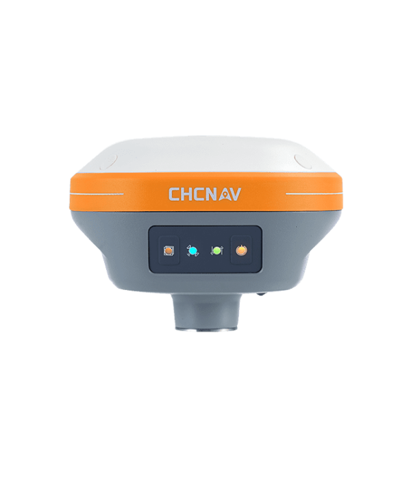
i73+ IMU-RTK GNSS
Compact GNSS base station and rover for maximum flexibility
BEST-IN-CLASS SIGNAL TRACKING
The advanced 1408-channel GNSS technology integrates GPS, GLONASS, Galileo, and the latest BeiDou III signals, ensuring robust data quality and maintaining centimeter-level survey-grade accuracy. The i73+ enhances GNSS surveying capabilities, making the process more efficient than ever.
THE POWER OF GNSS+IMU RTK TECHNOLOGY
The i76 GNSS is designed for challenging environments, featuring a 4th Gen air-medium GNSS antenna and a hybrid GNSS engine for robust tracking of all GNSS constellations and resistance to interference. With iStar 2.0 technology, it achieves an RTK fix rate exceeding 96%, making it suitable for areas with high ionospheric activity. When paired with CHCNAV base stations, it offers UHF coverage up to 25 km in standard conditions and 5-8 km in obstructed areas, ensuring reliable data across various surveying scenarios.
ULTRA-IMU TECHNOLOGY
The i76 features a 5th Gen interference-free Ultra IMU operating at 200 Hz, enhanced by EKF algorithms for precise measurements. It offers automatic pole tilt compensation, maintaining accuracy within 3 centimeters at a 60-degree tilt, ensuring reliable tilt measurements. The device simplifies use with a “poke-and-measure” feature that eliminates the need for manual IMU initialization or bubble centering. The IMU operates effectively regardless of the range pole’s position, whether handheld, shoulder-mounted, or horizontally placed.
PALM-SIZED WITH GNSS, IMU AND DUAL CAMERAS
The i76 is a lightweight (450g) yet rugged surveying tool that integrates GNSS, Auto-IMU, and dual cameras for seamless performance. It features IP68 protection and is resistant to drops from up to 2 meters, with a durable biomimetic design and sapphire camera lenses to withstand harsh conditions and resist impacts. With intelligent cloud-based OTA upgrades and an energy-efficient lithium battery, the i76 offers over 17 hours of continuous operation, ensuring reliability in the field.

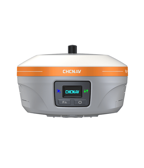
iBase GNSS
Integrated, rugged and reliable GNSS
base station for optimal ease of use
THE CONCEPT OF GNSS RTK STATION REDEFINED
The iBase GNSS station is a compact, all-in-one RTK GNSS solution that eliminates the need for cables and external batteries, making operations simpler and more efficient. Its streamlined setup process boosts work efficiency by at least three times compared to traditional external radio systems. Additionally, the iBase features a built-in 4G modem for transmitting GNSS corrections via a TCP/IP server.
BEST GNSS SIGNAL TRACKING IN ITS CLASS
The advanced 1408-channel GNSS technology utilizes GPS, GLONASS, Galileo, and BeiDou, ensuring robust positioning. The iBase GNSS combines innovative antenna technology with multipath mitigation algorithms, delivering high-quality GNSS corrections to rovers.
LOWER CONSUMPTION, LONGER AUTONOMY, BROADER COVERAGE
The iBase GNSS electronics design optimizes power consumption without compromising the performance of the UHF modem. It features two high-capacity removable batteries that deliver up to 12 hours of continuous operation while transmitting RTK corrections at a 5-watt output. The UHF modem can reach a coverage of up to 25 km in ideal conditions and 5 km in challenging environments like wooded and suburban areas.
INDUSTRIAL GRADE DESIGN
The iBase GNSS base receiver is designed for reliability in any working environment. It features an industrial design that meets the IP67 standard for water and dust protection, and its IK08 impact protection ensures durability, allowing it to survive accidental falls from tripod height onto hard surfaces.
e-Newsletter
Sign up for our newsletter to stay updated on the latest innovations, product launches, insightful case studies, and exclusive event invitations.
CONTACT US
- [email protected]
- +61 730 400 587
- Australia
Explore
- Our Services
- Products
- About Us
company
- Support
- Distributions
- Case Study
help center
- Contact
- Feedback
