
GNSS Sensors

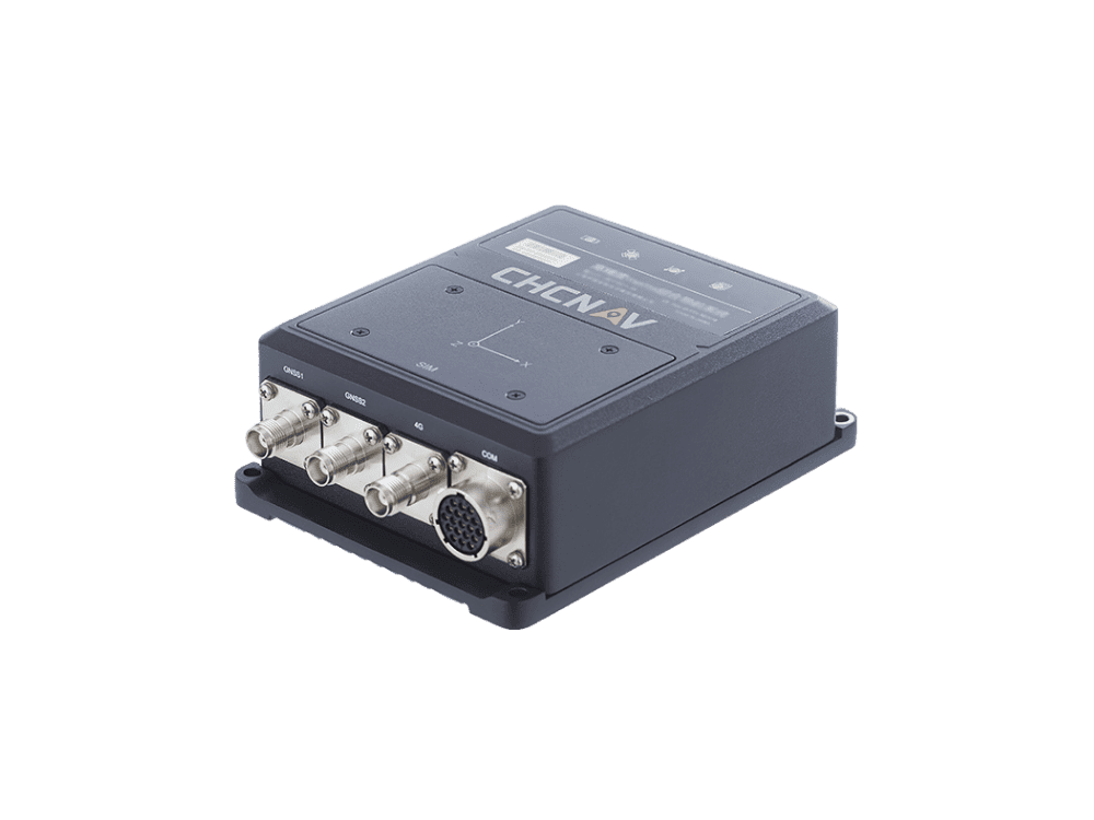
CGI-610
TIGHTLY COUPLED HIGH-
PERFORMANCE GNSS/INS SYSTEM
ROBUST POSITIONING AND ATTITUDE
A dual-antenna GNSS system, combined with industrial IMU MEMS, delivers continuous, reliable, and high-precision real-time positioning and orientation, even in challenging environments with GNSS signal interruptions.
HIGH-RELIABILITY INDUSTRIAL DESIGN
The CGI-610 GNSS/INS is designed for harsh environments with its IP67 dust and water resistance, industrial-grade power management, and protection against vibration, shock, and electrostatic discharge.
HIGH-FREQUENCY OUTPUTS
The CGI-610 is a high-performance GNSS/INS system that can provide precise navigation data at a very high rate (up to 100 Hz). It's suitable for applications that require rapid updates, such as airplanes, trains, and cars. Additionally, it can be enhanced with an external odometer sensor for ground vehicles to improve the accuracy of its position and speed calculations.
EXTENDED CONNECTIVUTY & WEB CONFIGURATION
The CGI-610 GNSS/INS is a highly accurate positioning and attitude sensor that offers fast RTK initialization, high connectivity, and versatile compatibility for various applications.
P5E-Net
GNSS reference station for
uninterrupted performances in geodetic
and scientific applications.
MULTI-CONSTELLATION TRACKING
The P5E Net reference station, equipped with a 336/768-channel GNSS core engine, delivers geodetic-grade accuracy for surveying projects and scientific applications.
SMART DATA MANAGEMENT
The system offers large storage capacity with the ability to cycle GNSS data recording and supports up to 8 independent logging sessions, optimizing memory management. GNSS data can be accessed securely through a web interface, a built-in FTP server, or pushed to remote FTP sites for added flexibility.
L-BAND PPP CORRECTIONS
The P5E GNSS offers sub-decimeter positioning accuracy by connecting to third-party L-Band correction services, making it effective in areas without RTK networks, GSM coverage, or traditional GNSS base stations.
24/7 UNINTERRUPTED OPERATION
The P5E Net is ideal for GNSS reference station deployment, featuring two external power inputs and Power over Ethernet (PoE) for reliable power options. Its internal 17,000 mAh battery provides up to 20 hours of backup operation during power failures.

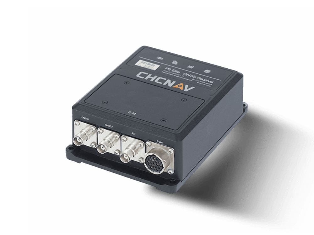
P2 ELITE GNSS
Advanced dual-antenna high-precision
positioning and heading sensor for
demanding applications.
SUPERIOR GNHIGH PERFORMANCE POSITIONING AND HEADINGSS TECHNOLOGY
The P2Elite GNSS sensor features advanced, field-proven dual antenna technology for positioning and heading, compatible with current and future GNSS signals. It also supports Trimble RTX and OmniSTAR correction services.
EXTENDED AND RUGGED CONNECTIVITY
The P2Elite GNSS Sensor provides exceptional compatibility with industrial and machine applications, featuring serial ports, optional CAN Bus protocol, RJ45 Ethernet connectivity, and low-latency PPS output.
HIGHLY INTEGRATED COMMUNICATION DESIGN
The P2Elite GNSS sensor offers advanced connectivity for precise positioning and heading using RTK correction sources. It connects to RTK networks through NTRIP/TCP corrections via its 4G modem or receives UHF GNSS station corrections on-site using its internal radio modem.
TRULY MULTI-APPLICATIONS
The P2 Elite is a highly powerful and versatile GNSS receiver designed to meet a wide range of application requirements with precision.
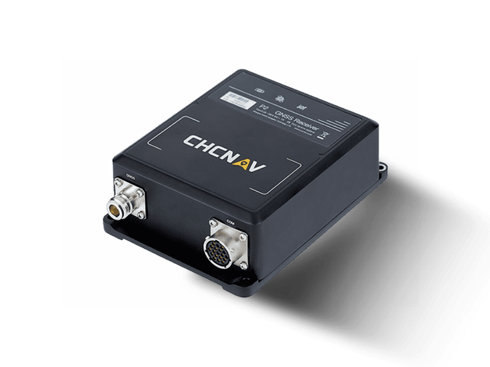
P2 GNSS
Designed to provide robust real-time
centimeter level GNSS positioning to
static or dynamic application
MULTI-CONSTELLATION FOR EXTREME POSITIONING
Powered by a 336-channel GNSS core engine, the P2 GNSS provides centimeter accuracy to any positioning applications.
EASY INTEGRATION AND CONFIGURATION
The P2 GNSS sensor is easy to install and set up. Just connect to the P2 GNSS ethernet port and get immediate access to advanced control to its configuration.
HIGH-RELIABILITY INDUSTRIAL DESIGN
IP67 dust and water resistance certification and integrated industrial-grade power management circuit provide reliable and constant performances in most difficult environment.
EXTENDED AND RUGGED CONNECTIVITY
Supports serial ports, RJ45 ethernet connectivity and low latency PPS output.
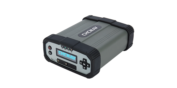
P5 GNSS
Smart GNSS geodetic reference station
for CORS and GNSS networks
applications
624-CHANNEL ADVANCED GNSS TRACKING TECHNOLOGY
The 624-channel P5 GNSS simultaneously tracks signals from GPS, GLONASS, Galileo, BeiDou, and SBAS satellites with outstanding GNSS raw data quality. Furthermore, the integration of the P5 GNSS reference stations as the foundation of RTK networks guarantees optimal GNSS RTK corrections resulting in the highest quality GNSS rover positioning.
VERSATILE NETWORK CONNECTION MODES
The P5 enables remote connections through Intranet, Ethernet, 4G, and Wi-Fi for easy access, configuration, and data transfer. Its redundant network connectivity automatically switches between Ethernet and 4G to ensure stable GNSS data streaming. It supports OpenVPN for intranet access and multiple protocol stacks for HTTP/HTTPS web access without needing a static IP. Additionally, the P5 features robust security measures, including multiple user permissions, web interface restrictions, HTTPS encryption, and a built-in firewall with port and MAC filtering to prevent unauthorized access.
MULTIPLE POWER SOURCES & INDUSTRIAL DESIGN
The P5 offers reliable DC and AC external power inputs for continuous operation, with a robust design yielding a mean time between failures (MTBF) of over 35,000 hours. It includes a high-capacity 17,000 mAh battery that provides up to 20 hours of backup during power outages. The system ensures 24/7 uninterrupted operation, features remote monitoring capabilities, and displays real-time status updates. With an IP67 rating, it is resistant to water and dust, minimizing downtime from environmental factors.
OPTIMAL SOLUTION FOR GNSS NETWORKS
CPS (CHCNAV Precision Service) is an advanced software for GNSS RTK networks, compatible with QZSS and BDS III navigation systems. It meets the needs of regional and national CORS and GNSS RTK networks by creating error resolution models for ionospheric and tropospheric delays, orbital errors, and multipath effects. The software offers optimized spatial error corrections through an enhanced virtual reference station, ensuring reliable RTK fixed-rate positioning accuracy. Additionally, its control module monitors P5 GNSS operations, network status, and data quality in real-time.
SMART DATA MANAGEMENT
With 32GB of internal storage and up to 1TB of external storage, the P5 can simultaneously record up to 8 separate data sessions, providing data storage in the standard Rinex 3.02 format for up to 7 years. In addition, its embedded FTP server or FTP push to a remote site ensures data integrity and ease of use.

P5E GNSS
GNSS reference station for
uninterrupted performances in geodetic
and scientific applications.
MULTI-CONSTELLATION TRACKING
Powered by a 336-channel GNSS core engine, the P5E GNSS reference station provides geodetic-grade accuracy to any surveying project and scientific applications.
24/7 UNINTERRUPTED OPERATION
Two external power inputs plus additional Power over Ethernet (PoE) sources make the P5E GNSS the ultimate choice for GNSS reference station deployment. Its 17 000 mAh internal battery capacity supports up to 20 hours of backup operation in case of power failure.
L-BAND PPP CORRECTIONS
Connected to 3rd party L-Band corrections services, the P5E GNSS provides accurate, sub-decimeter positioning in virtually all regions where RTK networks, GSM coverage or traditional GNSS base station are not available.
SMART DATA MANAGEMENT
Large storage capacity, cycling GNSS data recording and up to 8 independent logging sessions ensure the most efficient memory management. GNSS data can be accessed via a secured web interface, built-in FTP server, or configured to be pushed to remote FTP sites.
e-Newsletter
Sign up for our newsletter to stay updated on the latest innovations, product launches, insightful case studies, and exclusive event invitations.
CONTACT US
- [email protected]
- +61 730 400 587
- Australia
Explore
- Our Services
- Products
- About Us
company
- Support
- Distributions
- Case Study
help center
- Contact
- Feedback